A Giant Impact Basin on the Red Planet
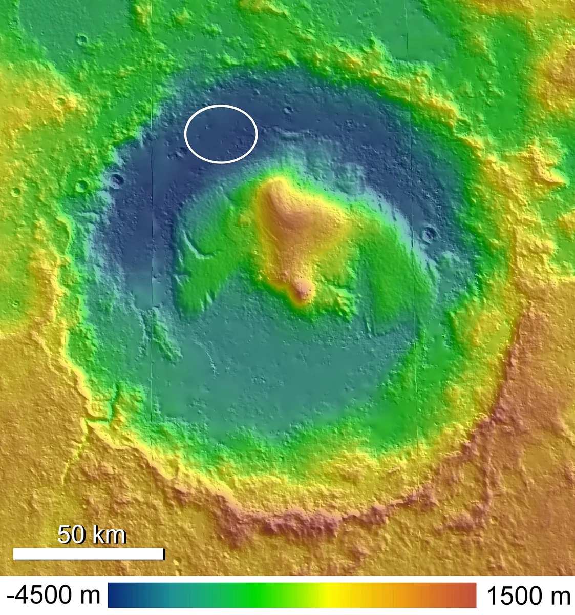
Gale Crater sits near the equator of Mars at about 5° south latitude and 138° east longitude. The depression spans roughly 154 km (96 mi) across – a size comparable to the U.S. states of Connecticut or Rhode Island. It formed 3.5‑3.8 billion years ago when a large asteroid or comet struck the planet, blasting out rock and ejecta that settled around the rim. Over time, wind‑driven erosion reshaped the interior, leaving a central mound of layered sediments that rises dramatically above the crater floor.
Mount Sharp: A Layer‑Cake Mountain
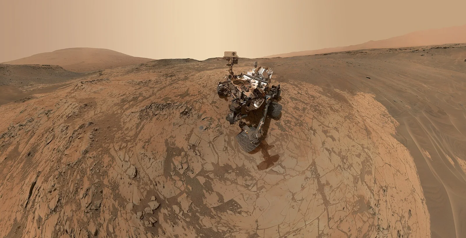
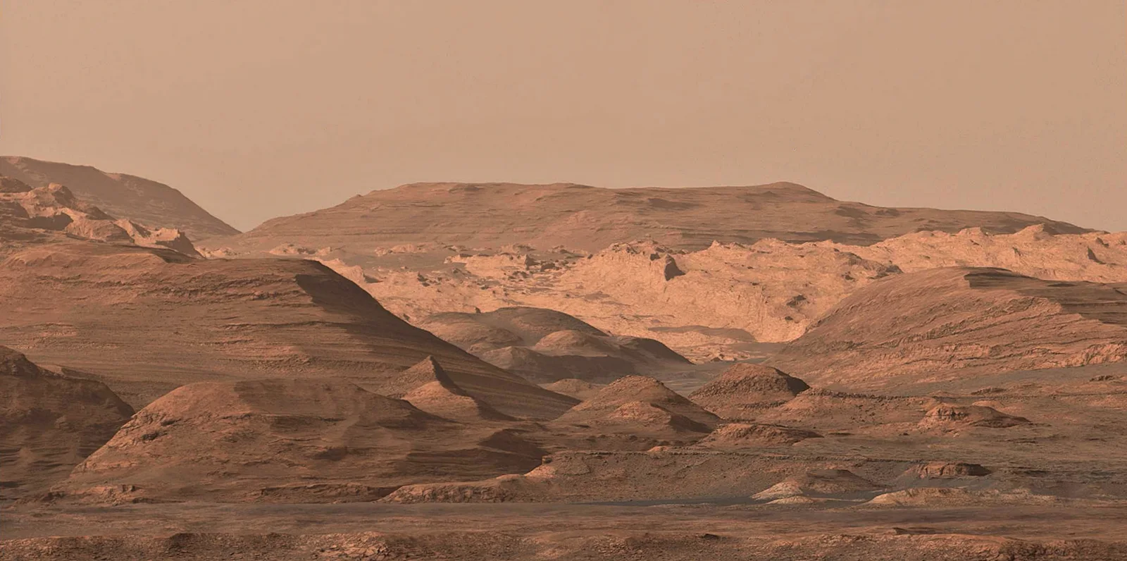
At the heart of Gale rises Aeolis Mons, informally called Mount Sharp in honor of geologist Robert P. Sharp. The peak towers about 5.5 km (18,000 ft) above the surrounding plain, making it taller than many Earth mountains relative to their bases. Scientists interpret the mound as the eroded remnants of sedimentary layers that once filled the crater, perhaps when it hosted a standing lake. The strata are exposed in striking bands, each representing a different epoch of deposition and weathering – a natural archive of Mars’ early environment.
Evidence of an Ancient Lake
Multiple lines of observation point to a lake that existed in Gale shortly after the impact. Satellite instruments detected clays and sulfates in the lower crater bench – minerals that typically form in watery settings. On‑ground, Curiosity examined mudstones and cross‑bedded sandstones that resemble deposits formed on lake margins and river deltas. Features such as the Pancake Delta, Western Delta, and the fan from Peace Vallis record how water once flowed into the basin, spreading sediments across the floor.
Curiosity’s Historic Touchdown
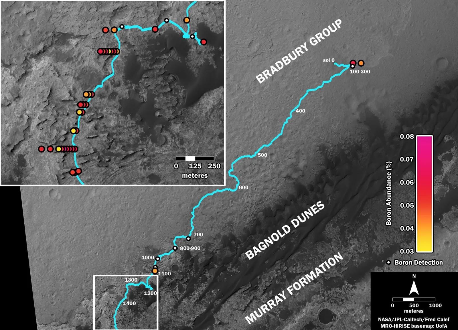
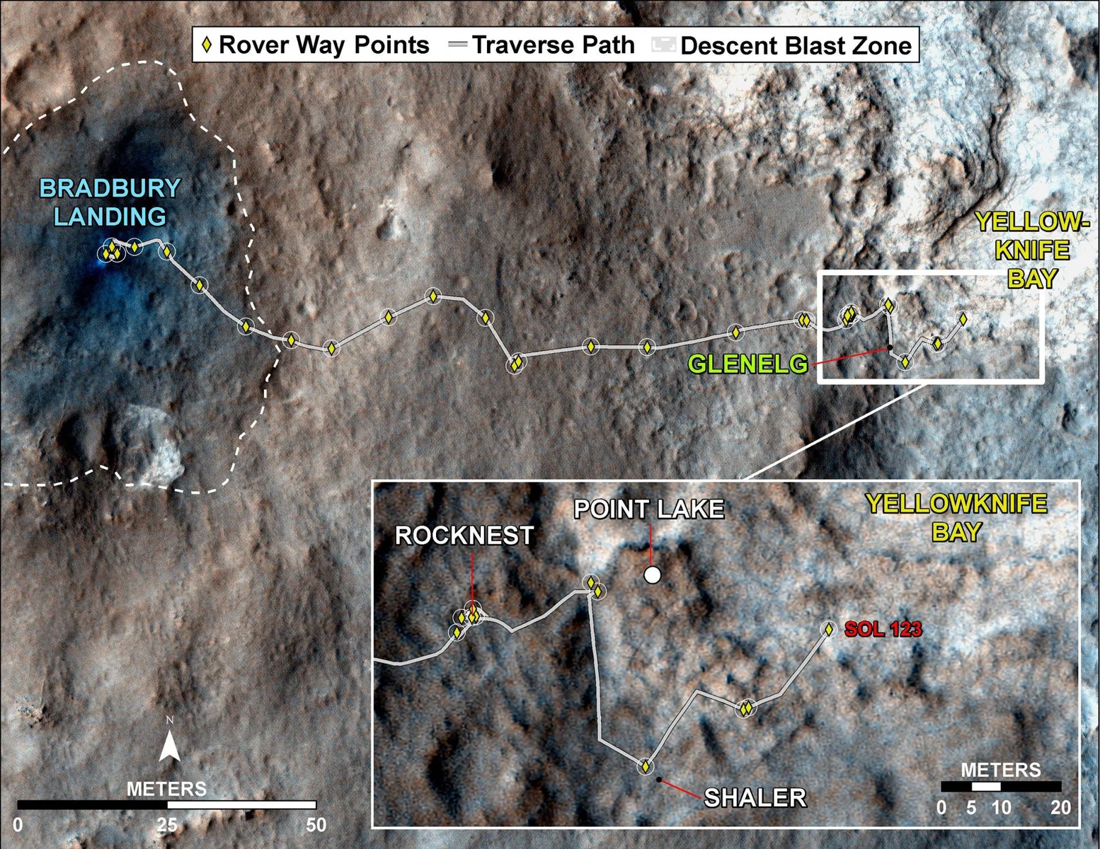
NASA’s Mars Science Laboratory rover, Curiosity, touched down on the Aeolian‑shaped plain known as Aeolis Palus on August 6 2012 (UTC). The landing site, nicknamed Bradbury Landing, lies at the foot of Mount Sharp within a 7 × 20 km ellipse. Curiosity’s instruments have since climbed the mound, sampling rocks from the Bradbury Group (including the Yellowknife and Kimberley formations) and the overlying Mount Sharp Group. These layers reveal a transition from river‑derived conglomerates to fine‑grained mudstones, supporting the lake‑bed hypothesis.
Geological Storytelling Through Rock Layers
The crater’s stratigraphy is divided into several formal units. The older Bradbury Group records fluvial activity – conglomerates, sandstones with ripple marks, and mudstones that suggest streams delivering material into the basin. Above it lies the Murray Formation, a laminated mudstone interpreted as lake‑floor sediment, capped by thin sandstone layers that indicate periodic inflow events. Higher up, the Mount Sharp Group consists of alternating clay‑rich and sulfate‑rich beds, hinting at shifting water chemistry over billions of years. An unconformity separates the Mount Sharp Group from the younger Siccar Point Group, marking a major gap in the geological record.
Why Gale Matters for the Search for Life
Because Gale preserves a long, continuous sedimentary record, it offers a unique laboratory for probing Mars’ habitability. Clay minerals can trap and protect organic molecules, while sulfate layers may record chemical conditions that could have supported microbes. Curiosity’s onboard analyses have detected simple organic compounds and fluctuating levels of methane, sparking ongoing debate about their origins. While no definitive biosignatures have been found, the crater’s history of liquid water makes it a prime target for future missions seeking definitive evidence of past life.
Looking Ahead: From Crater to Colony
Understanding Gale’s environment helps engineers design habitats and life‑support systems for eventual human explorers. The presence of ancient lake sediments suggests that subsurface water or ice could be accessed for drinking, agriculture, or fuel production. As the Mushroom 2 Mars project imagines cultivating fungi on Martian soil, Gale’s layered regolith provides a real‑world analog for testing how mushrooms might grow in mineral‑rich, low‑organic substrates.
Gale Crater continues to reveal the story of a planet that once flowed with water, offering clues that could one day help us grow life on Mars.
Sources
This article was prepared with AI assistance from the sources listed above and approved by the Mushroom 2 Mars team before publication.